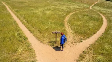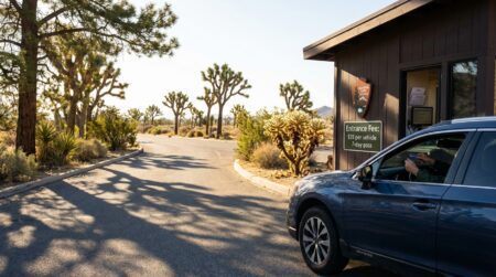


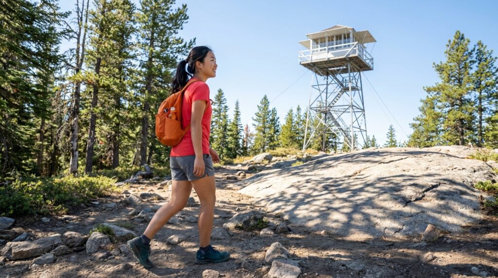
Fire lookout hiking trails are maintained paths that lead to historic fire towers built across US national forests and parks specifically to spot wildfires before they spread. Most are short. Most end at a view that takes 30 seconds to describe and an hour to stop looking at. And most fire lookout hiking trails were originally designed to be accessible to fire crews on foot, which means the approach tends to be well-graded, consistently marked, and shorter than hikers expect from the views they deliver.
⚡ Quick Trail Takeaways
- Historic Navigation Points: Lookout towers offer 360-degree panoramic vantage points with distinct summit destinations.
- Gradient Profile: Lookout trails follow steady historic pack-mule switchbacks with predictable, consistent slope grades.
- Safety Considerations: Never climb condemned tower stairs or access closed catwalks during lightning storm conditions.
I hiked to the Watchman Fire Lookout at Crater Lake National Park two Septembers ago with my sister, who had done exactly zero hikes before that day. The trail is 1.6 miles round trip with 420 feet of elevation gain. She had no trekking poles, was wearing borrowed trail runners a half size too large, and stopped twice to ask if we were almost there. When we reached the 1905 lookout cab at the top, she turned a slow full circle on the catwalk, looked out at the entire caldera and the lake 1,000 feet below, and said nothing for about a minute. Before we reached the car, she asked me how to find other trails like this one.
That is the pattern. It repeats. This guide covers what fire lookout hiking trails actually are, the seven specific reasons they work so consistently well for beginners, what to expect when you hike one, how to find the easiest fire lookout hikes close to you, and the answers to the questions beginners ask most before their first fire tower hike.
🥾 Oliver’s Trail Notes & Field Observations
Hiking to the historic Vetter Mountain fire lookout in the Angeles National Forest has been one of my favorite shake-down routes for years. In my experience, fire lookout destinations are ideal for beginner hikers because fire towers were historically erected on prominent summits with sweeping 360-degree vistas, and the access paths frequently follow maintained Forest Service fire roads with gentle, consistent climbing grades.
What Fire Lookout Hiking Trails Actually Are
The history behind the towers
Fire lookout hiking trails exist because the towers at the end of them exist, and those towers were built for a specific purpose over a defined historical period.
The US Forest Service and the National Park Service constructed most fire lookout towers between 1910 and 1940, following a series of large wildfire events, including the 1910 fires in Idaho and Montana that burned more than 3 million acres in two days. The response was systematic: build high, staff continuously, and catch fires while they were still small. According to the USDA Forest Service, the national lookout system peaked in the 1950s with more than 8,000 staffed towers operating simultaneously across the country.
Today fewer than 1,000 original structures remain, with around 400 actively staffed during fire season. The towers that survived were the ones built on peaks with the best sightlines in their region. Which means the fire lookout hiking trails that lead to them were engineered to reach the highest, most panoramic points in their respective mountain ranges. That engineering decision still benefits hikers 80 years later.
The USDA Forest Service maintains records of staffed fire lookouts and trails with access at fs.usda.gov. Unstaffed towers are managed by individual national forests and vary in condition from fully restored to stabilized ruins.
What you find at the top
Historic fire lookouts follow a standard design. The cab, which is the glass-enclosed room where the lookout operator works, measures 14 by 14 feet and sits on a platform elevated high enough to see over the surrounding tree canopy in every direction. Inside: an Osborne Fire Finder, a rotating metal ring over a large topographic map used to triangulate smoke locations. Outside: a metal catwalk encircling the structure. The view from that catwalk is 360 degrees with nothing blocking it.
Not every fire tower hike ends at an open cab. Some towers are locked outside staffed season. Others have open platforms with interpretive signs. Many historic fire lookouts are available for overnight rental through the USDA Forest Service at recreation.gov. Before your hike, check the current AllTrails listing and the relevant national forest website to know exactly what you’re arriving at.
7 Reasons Beginners Love Fire Lookout Hiking Trails
Reason 1: The distance-to-payoff ratio is different here
Most fire tower hikes run between 1.5 and 4 miles round trip with 400 to 800 feet of elevation gain. That puts the majority squarely in Fama’s 🟢 Easy for Beginners or 🟡 Manageable for Beginners range. The view, though, reflects not the difficulty of your approach but the total height of the terrain the tower sits on. You walk in for the final half-mile of a peak that the surrounding landscape has been climbing toward for miles.
The result is a view that does not correspond to a 2-mile hike. For beginners calibrating the effort-to-reward equation of hiking for the first time, fire lookout hiking trails demonstrate what outdoor effort can produce more efficiently than almost any other trail type in that distance range.
Reason 2: There is a real destination
One thing beginners consistently find disorienting about their first few hikes: not knowing what they are walking toward. A trail that ends at “a scenic viewpoint near the summit” leaves you checking the map every 20 minutes, unsure whether you have passed the good part or are still approaching it.
Fire lookout hiking trails solve this completely. The tower appears on the approach. You see what you are walking toward before you arrive. For someone navigating a trail for the first time, having a visible, unambiguous landmark removes a specific source of low-grade trail anxiety that many beginners cannot name but consistently report.
I did not register this as a reason to recommend fire lookout trails until my sister mentioned it on the descent: “I liked that I could see where we were going.” That comment came up again when she described the hike to a coworker the following week.
Reason 3: You are walking into a working piece of history
Historic fire lookouts are not viewpoints with a structure attached. The Osborne Fire Finder in the cab is original equipment. The register books going back decades list the names of every fire season crew member who lived in that 14-by-14-foot room for two months at a stretch. The construction in many cases was done by Civilian Conservation Corps crews in the 1930s, which is visible in the joinery and the stonework on the access paths.
Some towers have interpretive panels. Some have staff on-site during fire season who will explain the fire detection system and describe what smoke looks like at 30 miles on a clear day versus a hazy one. That conversation, if you catch a staffed lookout in a non-alert period, is genuinely one of the more interesting things you can do on a maintained day hike in this country.
Reason 4: The views are structurally different from any other trail type
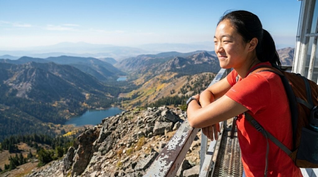
Most trails with strong views require either a long approach or technical terrain to reach a natural highpoint. Fire lookout hiking trails are a category exception. The tower adds 50 to 80 feet of height above an already elevated position, and those feet matter: they push you above whatever tree canopy remains at the summit. Looking out from a catwalk, you see in every direction with no obstruction. There is no awkward side to stand on. There is no partially blocked view depending on which rock you find. The 360-degree exposure is structural, built into the design of the thing.
For a beginner trying to understand what experienced hikers mean when they describe a trail as worth the effort, fire tower hiking views answer that question more clearly than almost anything in the beginner-accessible distance range.

Reason 5: The trail approaches are better than average
Fire roads run to most fire lookout towers, which means the approach trail has either been a road at some point or runs alongside maintained vehicle access. That history produces above-average trail conditions: graded slopes, cleared sight lines, predictable footing. Many fire lookout hiking trails have been maintained continuously since the 1930s because the towers require reliable access during fire season regardless of weather or use level.
For a first-time hiker, this consistency matters practically. The footing is more stable. The grade changes are more gradual. You spend less attention managing technical terrain and more attention on the walk and the view developing ahead of you. That is a better first-hike experience.
Reason 6: Navigation is genuinely simple
Scenic beginner trails are described as “well-marked” often enough that the phrase has stopped meaning much. Fire lookout hiking trails tend to be genuinely well-marked because the trails were engineered for crews who needed to reach the tower reliably in smoke, poor visibility, and unfamiliar conditions. Most lead from a clearly signed trailhead to a single destination with no significant junctions or navigation decisions along the way.
For a beginner who is nervous about wrong turns or off-trail sections, the structural simplicity of fire lookout trail navigation is real. Download the AllTrails route the night before. Follow the trail. The tower appears. That process removes the navigation anxiety that stops some people from trying unfamiliar trails entirely.
💡 Trail Tip: Download the AllTrails map offline the night before your hike, not in the trailhead parking lot.
Cell service at fire lookout trailheads varies widely, and loading a full trail map on two bars of signal often fails to complete. A map downloaded at home on reliable WiFi gives you GPS tracking the entire hike with no signal dependency.
Reason 7: You get space at the top
Popular viewpoints on accessible trails fill up fast. A rock overlook at the top of a 2-mile trail on a Saturday morning in summer will have 15 people on it by 9 AM. The platform is crowded. People rotate through quickly without quite settling in.
Fire lookout towers have limited catwalk space: comfortable for 4 to 8 people, no more. Groups naturally rotate through, and the structure itself creates an informal rhythm. You spend 20 minutes on the catwalk rather than 4 minutes on a crowded overlook. That difference in the experience at the top, the time to actually take it in, is one of the specific reasons that people who find fire lookout hiking trails tend to come back to them.
🥾 Lookout Etiquette & Catwalk Safety
During my visits to active towers like Slide Mountain and Keller Peak, I learned that fire lookouts are operational federal observation stations. While volunteer lookouts often welcome visitors and demonstrate traditional fire-finder instruments, always respect posted quiet hours, keep trekking pole tips pointed down on wooden staircases, and hold handrails securely on gusty observation decks.
What to Expect on a Fire Tower Hike
Trail surface and grade
Most fire tower hikes move at a steady uphill grade from the trailhead to the tower, followed by the same route back. The surface varies by region: packed dirt and gravel in the Pacific Northwest, rocky switchbacks in the Rockies, wide converted dirt roads in the Southeast and Appalachians.
The final 200 to 400 feet of elevation gain are almost always the steepest section of any fire tower hike. Fire lookouts are built on highpoints, and the terrain immediately below those highpoints tends to pitch upward. Take that section at whatever pace lets you maintain a conversation without stopping. There is no advantage to rushing it, and the view at the top will still be there if you arrive two minutes later.
What to bring on fire tower hikes
The standard day hike packing list covers everything you need. On fire tower hikes specifically, two items matter more than they do on shaded forest trails.
Water. The catwalk at the top of a fire lookout tower has no shade and frequently has wind, which accelerates dehydration without the subjective sensation of heat. Bring at least 0.5 liters per mile of trail plus an additional 0.5 liters for time spent at the top. A 3-mile round trip on a warm day requires a minimum of 2 liters.
An extra layer. The wind at tower elevation can drop the apparent temperature by 15 to 20 degrees even when the morning at the trailhead felt warm. A packable fleece or wind layer weighs under 8 ounces and solves the single most common source of discomfort at the summit.
💡 Trail Tip: If the tower is staffed, ask the lookout how the Osborne Fire Finder works.
Lookout staff often work solo for 2-week stretches and will explain the fire detection system, describe the season’s fire activity in the area, and point out peaks on the horizon by name. That conversation is not available at any other trail type. Most lookouts welcome it.
What “staffed” and “unstaffed” means for your visit
A staffed fire lookout has a Forest Service employee or trained volunteer in the cab during fire season, typically May through October depending on the region. During non-alert periods, the cab is often open to visitors and the catwalk fully accessible. The lookout may explain the fire detection equipment and answer questions about the surrounding terrain.
An unstaffed tower may be open with interpretive panels, locked with exterior access only, or a stabilized historic structure accessible at the platform level. Conditions vary by tower and change seasonally. Check AllTrails reviews from the last 60 days and the specific national forest website before your trip to know what you will find at the top.
The Easiest Fire Lookout Hikes in the US
How to find fire lookout hiking trails near you
The easiest fire lookout hikes are distributed across most states with significant national forest land. Oregon, Washington, California, Montana, Idaho, Colorado, North Carolina, Tennessee, Virginia, and across the Southeast all have maintained fire tower trails accessible to beginners. You are not looking for a specific region. You are looking for the right tool to find them.
AllTrails allows text filtering by trail name. Search “fire lookout” or “fire tower” and filter by your location radius and difficulty level. Cross-reference the results against the specific national forest website to verify current access and tower condition before committing.
The USDA Forest Service at recreation.gov lists fire lookout towers available for overnight rental. That list is also a useful index of maintained towers with trail access since rentable lookouts require consistent approach trails. Many of the easiest fire lookout hikes in the country appear on that list.
The American Hiking Society’s trail finder at americanhiking.org indexes scenic beginner trails nationally, including many fire lookout approaches, and filters by state and difficulty.
What to look for in a beginner-appropriate fire tower hike
For a first fire tower hike, target all four of these parameters:
- Round trip distance: 4 miles or under
- Elevation gain: Under 800 feet total
- Trail surface: Maintained dirt or gravel, no scrambling or off-trail sections
- Recent condition reports: Trip reports from within the last 30 days showing the trail and tower are accessible
Trails that clear all four place you in the 🟡 Manageable for Beginners range or better. The views from towers that meet these criteria are not meaningfully different from towers requiring harder approaches. The height of the tower compensates for any difference in surrounding terrain.
Fire Lookout Hiking Trails: Frequently Asked Questions
What are fire lookout hiking trails and who are they for?
Fire lookout hiking trails are maintained paths leading to historic fire towers built by the US Forest Service and National Park Service, primarily between 1910 and 1950. The trails were designed for working crews reaching the towers under any conditions, which makes most of them more accessible than their views suggest. Fire lookout hiking trails with under 4 miles of round trip distance and under 800 feet of elevation gain are appropriate for beginners on their first or second season of hiking. Most states with significant national forest land have at least several within reasonable driving distance.
Are fire tower hikes safe for beginners?
Fire tower hikes on maintained national forest trails are appropriate for beginners with standard day hike preparation. Bring 0.5 liters of water per mile plus buffer for time at the top, pack a wind layer regardless of the morning temperature, and check the forecast the morning of your hike at weather.gov for the trail’s specific area rather than the nearest city. The towers are elevated and exposed structures, which means wind is normal and the temperature at the top will be lower than at the trailhead. That is not a concern with a packable layer in your pack.
How do I find historic fire lookouts near me?
Search AllTrails using “fire lookout” or “fire tower” as a trail name filter and set the difficulty to easy or moderate. Cross-reference any result against the specific national forest website to verify current access and tower condition. The USDA Forest Service rental listings at recreation.gov catalog most of the country’s maintained fire lookout towers with trail access. The American Hiking Society at americanhiking.org indexes many scenic beginner trails nationally, including fire lookout approaches organized by state.
What is the view quality like compared to other scenic beginner trails?
Fire tower hiking views consistently outperform comparable-distance scenic beginner trails in view quality. The tower adds structural height above the natural highpoint, and the 360-degree unobstructed exposure from the catwalk produces a view experience that natural overlooks at the same elevation rarely match. The specific quality varies by location. The structural advantage of the tower design is consistent everywhere: you see farther, in more directions, with less obstruction than from any natural viewpoint at the same elevation.
Can I stay overnight in a historic fire lookout?
Many historic fire lookouts managed by the US Forest Service are available for overnight rental through recreation.gov, typically ranging from $75 to $150 per night. Peak season dates book out months in advance. The experience is specific: a 14-by-14-foot cab with a bed, a wood stove, and the Osborne Fire Finder, sitting on a peak at sunset and sunrise with a 360-degree view in every direction. For a beginner who has completed four or five day hikes and wants to try an overnight experience without tent camping, a lookout rental is a reasonable transition. You get the height, the view, and the historic structure without any of the tent setup.
Are the easiest fire lookout hikes appropriate for children?
The easiest fire lookout hikes on maintained national forest trails are appropriate for children who can manage 2 to 4 miles of uphill terrain. The visible destination on approach holds attention better than an abstract viewpoint, and the historic structure at the top genuinely interests most kids in a way that a rock overlook does not. Keep pack weight under 20% of their body weight, plan for a pace 25 to 30% slower than your own, and bring more snacks than seems necessary. Before you go, verify whether the tower’s top level is accessible by staircase or open-rung ladder. Open-rung ladder access requires a different risk assessment for young children than enclosed staircase access.
Fire Lookout Hiking Trails Are the Trail That Keeps Working
Fire lookout hiking trails are one of the few trail types where a beginner and an experienced hiker arrive at the same catwalk and have essentially the same experience. The history is in the same structure. The wind is the same wind. The Osborne Fire Finder sits in the same cab. None of that requires 50 miles of prior trail time to appreciate.
My opinion: fire lookout hiking trails are the single best starting point for beginners who want evidence that hiking delivers something proportional to the effort. The answer is yes, and fire tower hikes make that clear faster than almost anything else you can do on foot in a national forest.
My sister has done six fire tower hikes since that September in Crater Lake. She plans them herself, filters AllTrails for “lookout” and “tower” in trail names, and checks recreation.gov availability before summer for overnight rentals. She started on 1.6 miles with borrowed shoes that did not fit.
For your first fire lookout hiking trail, stay under 4 miles and under 800 feet of elevation gain. Download the AllTrails map offline the night before. Bring 2 liters of water and a wind layer. Those two preparation steps cover the only things that differ from a standard short day hike.
Next Steps
- Right now: Search AllTrails for “fire lookout” or “fire tower” filtered to easy and moderate difficulty within 50 miles of your location. Look at photos from the last 60 days to verify current tower condition and access.
- Before your first fire tower hike: Check the specific national forest website for that tower’s current access status and whether it’s staffed. Download the AllTrails route offline at home, not in the trailhead parking lot.
- Day of: Bring at least 2 liters of water and one packable wind layer regardless of the morning forecast. The catwalk is open and exposed, and both items solve the two most common discomforts people experience at the top.
Related Reads
Bought half of a “must-have gear” list before realizing most of it was just upsell padding? Here’s a breakdown of the real 10 essentials for hiking, the stuff that actually matters versus filler.
Finished a hike completely wrecked and quietly started wondering if maybe hiking just wasn’t for you after all? Here’s an honest look at why hiking feels so hard at first, and exactly when that starts to change.
Tired of hiking solo but not sure where you’d even find people who actually want to come along? Here are 6 methods for finding hiking partners near you, beyond just posting in a random group chat.
Stared at a map of national parks and had zero clue which one would actually be friendly to a first-timer? Here are 5 steps to pick the right national park for your first visit, no overwhelm included.
Assumed every decent trail near you came with a parking fee or entrance pass attached? Here’s how to track down solid hiking trails near you that don’t cost a thing.