

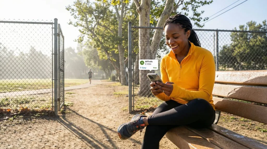
Finding beautiful, well-maintained hiking trails near you does not have to mean buying expensive annual park passes or paying hefty trailhead parking fees. Across the country, hundreds of millions of public acres—managed by county open spaces, state forest preserves, and the Bureau of Land Management—offer free trail access every day. The key is simply knowing which local maps and search filters to use so you can uncover hidden paths right in your backyard.
Trail Note: When I first started hiking, I had to learn this the hard way. Here is what I discovered from my own time out on the trails.
⚡ Quick Trail Takeaways
- Public Land Types: US Forest Service, BLM lands, and local county parks feature 100% free access.
- App Filters: Use free tiers of AllTrails, Hiking Project, and Gaia GPS filtered by ‘No Fee’.
- Parking Permits: Verify whether trailhead parking requires a regional pass (e.g. Discover Pass, NW Forest Pass).
That is the situation for most people starting out: free hiking trails near you are almost certainly closer than you think. The problem is not supply. Publicly managed land in the United States covers roughly 640 million acres, managed by the National Park Service, the US Forest Service, the Bureau of Land Management, and state and county park systems. The vast majority of trails on all of that land cost nothing to access. The problem is knowing how to find the right one for your fitness level, your time, and your vehicle situation.
This guide covers five apps that find free hiking trails near you without paywalls, how to read trail listings so you stop choosing trails that are wrong for your level, and where free trails exist that most search results miss entirely.
| Public Land Category | Access Fee Required? | Trail Availability | Best Tool to Find |
|---|---|---|---|
| US National Forests | Free Access (Some Parking Passes) | Extensive (150,000+ Miles) | USFS Interactive Map / AllTrails |
| BLM Public Lands | 100% Free Access | Primitive & Wilderness Trails | BLM.gov & Gaia GPS |
| County & City Parks | Free Access | Local Groomed Day Trails | Local Parks Website / AllTrails |
How to Find Free Hiking Trails Near You
Why the first search usually fails
Type “free hiking trails near me” into Google and you get one of three things: a paid trail app marketing page, a listicle from 2019 with broken links, or a travel site recommending trails three hours from you. None of those are what you need.
The better search is not a Google keyword search at all. It is a filter in a trail app, and the specific filters matter more than the app you use. Every app on this list has a distance-from-you filter, a difficulty filter, and a length filter. Using all three simultaneously narrows 200 trail results to 8 usable ones in under two minutes. Most beginners skip the filters and scroll through results until they give up. Do not do that.
The other thing worth knowing before you start: free hiking trails near me is almost a redundant search in most of the US. The majority of trail systems accessible to the public are free. Paid access is the exception, mostly limited to state parks with vehicle day-use fees. Many of those parks still have trailheads accessible from free roadside parking if you know where to look.
What to check before you select a trail
Trail difficulty labels are not reliable across platforms. An AllTrails “Easy” is calibrated against the full AllTrails user base, which includes experienced hikers doing hard trails regularly. What AllTrails calls Easy may be Manageable to Challenging by Fama’s calibration for absolute beginners.
Use the numbers instead. Before you commit to any trail found in a free hiking trail search, check two things: total distance in miles and total elevation gain in feet. For most beginners on their first several hikes, stay under 4 miles and under 300 feet of elevation gain. That combination produces a trail that most fitness levels can complete without the last mile becoming an exercise in regret.
AllTrails shows both numbers on every trail card before you click through. So does Hiking Project. Gaia GPS requires you to open the trail detail page. Google Maps does not show elevation gain at all, which is one of its real limitations for trail selection.
The 5 Best Free Trail Apps
App 1: AllTrails (free tier)
What the free version actually gives you
AllTrails is the starting point for almost every beginner looking for free hiking trails near me, and the free version is more capable than most people realize before they try it.
The free tier gives you trail search with distance, difficulty, length, and elevation filters, plus GPS tracking during your hike. User reviews and photos are fully accessible, including the recent ones that tell you what the trail actually looks like right now versus what the listing photo was taken five years ago. You also get the out-and-back, loop, or point-to-point designation, driving directions to the trailhead, and the elevation profile graph. That is a lot of trail-finding capability for nothing.
What you do not get for free: offline maps. This is the real limitation. The AllTrails map requires cell service to load in real time. In areas with patchy coverage, the map can stall or disappear mid-hike. The paid AllTrails+ version ($35.99 per year as of early 2026) adds offline map downloads as its primary feature.
My honest opinion on this: the free version is the right starting point for every beginner finding local hiking spots within cell range. Do not pay for AllTrails+ until you are doing trails in areas where you know cell service is unreliable. For most urban and suburban beginner trails in the US, you will have enough signal for the free version to work.

App 2: Hiking Project by REI
Why this one gets overlooked
Hiking Project is genuinely free with no paid tier and no feature limitations for trail finding. REI built it and keeps it open, presumably because it functions as a trail discovery tool that eventually sends people into gear stores. Whatever the reason, that model works in your favor: there are no paywalled features.
The trail database is smaller than AllTrails, especially for urban parks and less-trafficked local hiking spots. Where Hiking Project earns its place on this list: trail condition reports. The platform emphasizes recent user condition updates more than AllTrails does, which makes it better for checking whether a specific trail is muddy, has downed trees, or had its trailhead parking closed in the last two weeks. I used it before a wet-season hike in early March and the condition report flagged a creek crossing that was running too high to cross safely. AllTrails had the same trail listed as open with no notes. That 30-second check saved a 45-minute drive.
Hiking Project also shows trail surface type more clearly than most apps. If you are deciding between two trails of similar length and elevation, and one is paved gravel while the other is loose rocky terrain, Hiking Project makes that distinction visible without clicking into the full trail detail page.
App 3: The NPS App and Recreation.gov
How to find federal land trails for free
The National Park Service app and Recreation.gov together cover roughly 85,000 miles of maintained trail on federal land, the majority of which costs nothing to hike. The apps themselves are free. Most of the trails in them are free.
The distinction between the two: the NPS app is trail discovery and maps for national park units specifically, while Recreation.gov covers booking for paid campsites and permits across multiple federal agencies. For finding free hiking trails near me on federal land, the NPS app is the practical tool. Recreation.gov is where you check whether a trail requires an advance permit before you drive 45 minutes to the trailhead and find out on arrival. I learned that the hard way at a popular desert trail that added a permit requirement mid-season. Checking Recreation.gov the night before would have taken two minutes.
The National Park Service publishes current trail conditions and closures by park unit, updated regularly by rangers. For any trail in a national park, checking that page the morning of your hike takes 90 seconds and prevents showing up to a closed trail.
One thing the NPS app does better than the best free trail apps for national park units: it flags whether a trail requires physical fitness above beginner level, using language calibrated to public visitors rather than experienced hikers. That calibration difference matters on your first several hikes.
App 4: Gaia GPS (free tier)
What the free tier actually gives you without paying
Gaia GPS is a navigation-first app built for hikers and backcountry users who need detailed topographic maps. The free tier gives you access to the trail database and basic GPS tracking. The limitation is significant: free users cannot download maps for offline use, and the base map layer in the free version is the standard topographic without the premium satellite and trail overlays that make Gaia GPS worth its $39.99 annual subscription for backcountry use.
For a beginner finding local hiking spots on maintained trails within cell coverage, the Gaia GPS free tier works. For anyone planning a trail with known spotty coverage or planning to be more than a mile from a developed trailhead, the free tier is genuinely not enough. I would rather tell you that directly than have you discover it at mile 2 of a trail with no signal.
Where the free tier adds value even for beginners: the topographic layer. Gaia GPS shows contour lines more clearly than AllTrails at equivalent zoom levels, which makes reading elevation change across a route easier. If you are trying to understand whether a trail’s elevation gain is concentrated in one steep section or spread gradually across the full distance, the topo view in Gaia GPS free shows you that faster than any other app on this list.
App 5: Google Maps
How to use Google Maps to find free hiking trails near you
This is the honest admission in this article: I dismissed Google Maps as a hiking tool for years, and I was wrong. It finds free nature trails and local hiking spots faster than any dedicated trail app if you use it correctly, and its data is more current than most trail databases because it updates from business listings, user reviews, and satellite imagery simultaneously.
The search that works: type “hiking trail” or “nature trail” or “trailhead” into Google Maps with your location active. Filter by “Parks” in the category filter. The results surface trails that are physically near you, including small county and municipal trails that AllTrails does not index, greenway connectors, and urban nature preserves that rarely appear in trail-specific searches.
What Google Maps cannot do: show elevation profiles, filter by difficulty, or give you turn-by-turn on-trail navigation calibrated to trail use. Those are real limitations. The tool to use Google Maps for is discovery, not navigation. Find the trail there, then cross-reference it in AllTrails or Hiking Project for the elevation data and recent reviews before you go.
Local Hiking Spots Most People Miss Entirely
Where free nature trails exist beyond the apps
The apps on this list index well-trafficked and officially maintained trails reliably. Three categories of free hiking trails near me consistently fall through the cracks of every trail database, and they are worth knowing about.
County and regional park greenways. Many counties maintain trail networks between parks, along creek corridors, and through conservation easements that do not appear in AllTrails and have minimal online presence. Your county parks department website is the direct source. Search “[your county] parks and recreation trails” and check whether the department maintains a trail map PDF. These are often the closest free nature trails to urban and suburban addresses, and they are genuinely empty on weekday mornings.
State wildlife management areas. Most states allow free public access for hiking on wildlife management areas managed by the state fish and wildlife agency. These are hunting and fishing management units that also function as informal trail systems. They are rarely marketed to hikers, have minimal infrastructure, and require a free download of the area boundary map to navigate reliably. The American Hiking Society’s trail finder resources reference these land types by state.
Army Corps of Engineers public land. The US Army Corps of Engineers manages 12 million acres of land around lakes and waterways, most of it open to free public access including hiking. These areas do not appear in most trail apps and have almost no online review presence, which means they are consistently less crowded than equivalent state park trails nearby.
How to find hiking trails in your specific area efficiently
Call the land manager. This sounds old-fashioned and it is genuinely faster than an hour of app searching for local hiking spots in areas with thin trail app coverage. The local ranger district for your nearest national forest, the county parks department, and the state park visitor center staff know exactly which trails near you cost nothing to access, which ones have good parking, and which ones see no crowds. That information is not online in most cases.
Common Mistakes When Looking for Free Hiking Trails Near You
Four patterns that produce the wrong results
Using the distance filter for driving distance instead of trail length. Both AllTrails and Hiking Project use “distance” to mean trail length, not distance from your location. Beginners regularly filter for “under 3 miles” thinking that means close to home and get results showing 3-mile trails 40 minutes away. The “near me” or “within X miles” search radius is a separate filter from trail length. Set both.
Trusting the difficulty label without checking the numbers. “Moderate” on AllTrails is calibrated to a user base that includes people who regularly do 12-mile mountain hikes. A Moderate trail might have 1,400 feet of elevation gain over 5 miles, which is not a beginner trail by any standard. Check the numbers before you trust the label. Under 200 feet of elevation gain per mile is the practical beginner threshold.
Finding free hiking trails near you with no parking plan. Free trails are not always accessible with free parking. State parks with free trails often charge vehicle day-use fees at their main entrance. Many of those same parks have satellite trailheads accessible from street parking nearby. AllTrails and Hiking Project both list parking information in the trail detail view. Read it before you drive out.
Skipping the recent reviews. Trail listings are static. Reviews are not. A trail listed as having good conditions in the app database may have had a creek crossing flood out two weeks ago or a parking lot close for construction last month. Sort AllTrails reviews by “Most Recent” and read reviews from the last 14 days before committing to a specific trail. The information is there if you look for it.

When Your Search Is Not Working
What to do when you cannot find free hiking trails near me
If every trail app search for local hiking spots produces options too far away, too difficult, or with conditions issues, three backup moves work reliably. All three point you toward where to hike for free on land that app databases consistently miss.
Search by park or land name rather than “hiking trail near me.” Type the name of a specific park or preserve you know exists near you into the app and browse what it contains. This sidesteps the radius search entirely and often surfaces shorter connector trails within a park that do not appear in distance-based trail searches.
Use the satellite view in Google Maps to look for green space within 5 miles of your location. Patches of green that are not golf courses or cemeteries usually indicate parks, preserves, or conservation land. Click into any green area to see whether it has a name and a parks department managing it. Most have public access.
If you are in a genuinely trail-sparse area, the Bureau of Land Management publishes free dispersed recreation maps for BLM land in your state at the BLM public land access portal. BLM land is open to public use including hiking with no permit or fee in most cases, and it covers large sections of the western US that trail apps significantly under-index.
How do I find free hiking trails near me without paying for an app?
AllTrails’ free tier, Hiking Project, and Google Maps all find free hiking trails near you without any payment. AllTrails free gives you full trail search with filters, GPS tracking during your hike, and access to all user reviews. Hiking Project is free with no paid tier at all. For trails not in either database, your county parks website and a search for BLM or national forest land in your area surface options that app databases miss.
Are all hiking trails free in the US?
Most trails on federal land, including national forests, BLM land, and many national park trails, are free to hike. The main exception is state parks, which often charge vehicle day-use fees at the main entrance. Those fees typically run $5 to $15 per vehicle. Many state parks have trailheads accessible from roadside parking outside the fee entrance. For truly free nature trails with no cost whatsoever, national forest trails and county park greenways are the most consistently free options.
What are the best free trail apps for finding local hiking spots?
AllTrails free is the most practical tool for most beginners finding local hiking spots because it has the largest trail database in the US, the most current user reviews, and filters that let you narrow by distance, difficulty, length, and elevation in one search. Hiking Project is the best free alternative with no paid tier. For federal land trails specifically, the NPS app adds detail on national park units that AllTrails does not cover as thoroughly.
How do I find where to hike for free on public land near me?
The fastest route to free public land trails near you: search your state’s name plus “state forest trails” or “BLM land trails” to find publicly managed land open to hiking without fees. National forests allow free hiking throughout, with trails indexed in the USFS website and increasingly in AllTrails. For local options specifically, your county parks department website is the most direct source for free trails close to home that trail apps often do not index.
Why can’t I find good beginner trails in my area using hiking apps?
Most trail apps surface popular trails first, which often means more challenging ones with better photography and more reviews. To find hiking trails that actually match a beginner level, filter AllTrails or Hiking Project specifically for “Easy” difficulty AND length under 4 miles AND elevation gain under 300 feet simultaneously. Run that three-filter search before browsing results at all. Also expand your location radius beyond walking distance. A free hiking trail 15 minutes away by car that matches your level is better than a trail 5 minutes away that exceeds it.
How do I know if free nature trails near me have good conditions right now?
Sort AllTrails reviews by “Most Recent” and read the last 5 to 10 reviews specifically for trail conditions. Hikers consistently mention mud, downed trees, parking closures, and creek crossings that have changed since the official listing was updated. For national park trails, the National Park Service publishes condition updates at nps.gov by park unit, updated by rangers on an ongoing basis. Check both sources the morning of your hike, not the night before.
Free Hiking Trails Are Closer Than Your Search Results Suggest
Free hiking trails near me exist in almost every county in the US in numbers that the popular trail apps significantly undercount. The apps on this list get you to 90% of them. The county parks website and a phone call to your local ranger district get you the rest.
The filter combination worth running first on any trail app: within 15 miles, 2 to 4 miles long, under 300 feet of elevation gain. Run that search in AllTrails’ free tier this week and you will likely find at least three to five local hiking spots you did not know existed. Start with the one that has reviews from the last 30 days. That review recency tells you the trail is currently accessible and people are using it.
Next Steps
- Right now: Open AllTrails free and run the three-filter search: within 15 miles, under 4 miles, under 300 feet elevation gain. See what comes up. You are looking for a trail with at least one review in the last 30 days.
- Before your first hike: Cross-check your chosen trail in Google Maps. Confirm the trailhead address is correct, that parking exists, and that you know the driving route before the morning of the hike.
- Day of: Read the 5 most recent AllTrails reviews for your specific trail. Sort by Most Recent, not Most Helpful. Look for anything that mentions current conditions.
Frequently Asked Questions
Are National Parks free to hike?
Most major National Parks charge an entrance fee, but you can find free hiking in National Forests, BLM land, and local municipal parks.
What is the best app to find hiking trails?
AllTrails is widely considered the best app for discovering local hikes, featuring thousands of user-reviewed trails with difficulty ratings.
Related Reads
Trusted an app’s “easy” label and still found yourself stopping every five minutes to catch your breath? Here’s how AllTrails actually calculates those difficulty ratings, and why the number on screen doesn’t always match reality.
Heard someone mention a “lollipop loop” trail and had absolutely no idea what that meant? Here’s a rundown of the different types of hiking trails so the lingo stops being a mystery.
Assumed your usual evening walk basically prepared you for a real trail? These 5 differences explain why hiking demands more from your body than a flat sidewalk ever will.
Saw a trailhead sign with a rating system you’d never come across before and just guessed your way through it? Here’s what those difficulty ratings genuinely mean, broken down for someone brand new.
Noticed your calves screaming on a trail the map called “flat”? This is the real reason behind that — elevation gain hides in places distance numbers never show.