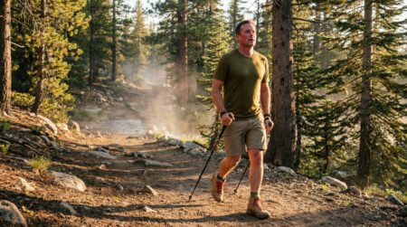
The best beginner hikes in the US are not the ones with the most dramatic views or the longest reputation. They’re the ones where the distance is honest, the surface is manageable, the navigation is clear, and you arrive home feeling like you could go again. That combination is rarer than most hiking content suggests.
⚡ Quick Trail Takeaways
Trail Selection Criteria: Beginners should target trails under 4 miles round-trip with under 500 feet of total vertical elevation gain.
Trail Condition Signals: Choose maintained Class 1 trails with clear signage, packed tread, and cell-reachable trailhead access.
Time Estimation: Budget 30 minutes per mile on flat terrain plus 30 minutes per 1,000 feet of climb for realistic planning.
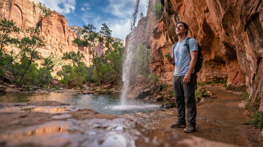
I did my first national park trail at Zion. Lower Emerald Pools, 3.0 miles, 150 feet of gain. I had been on local trails and thought I knew what to expect. What I didn’t expect was how different a well-maintained national park trail feels from a suburban county path: wider, better marked, with the terrain clearly designed so that effort and reward land at approximately the same time. I was at the lower pool in about 35 minutes. I sat on a rock next to the falls for longer than I hiked in. The ratio of trail time to experience quality was the best I’d had.
These 15 trails represent that ratio across five regions of the United States.
Table of contents
🥾 Oliver’s Trail Notes & Field Observations
When introducing friends to hiking in Southern California, I start them on trails with clear historical milestones, such as Echo Mountain via the Sam Merrill Trail or Chantry Flat to Sturtevant Falls. In my experience, novice hikers build endurance and confidence much faster on trails that offer clear visual waypoints every mile and manageable elevation gains under 1,200 feet, rather than unrelenting dirt ascents through dense brush.
How We Selected These Top US Hikes for Beginners
The selection criteria for this list
Every trail on this list of best beginner hikes in the US meets four conditions. Distance under 5 miles round trip. Elevation gain under 500 feet total. A well-maintained surface with clear junction marking. And recent AllTrails reviews confirming conditions that match the official rating.
The easy hiking trails USA filter on AllTrails returns thousands of results. Most of those trails are appropriate. What makes this list different is the fourth condition: recent reviews. A trail that checks out on paper may have a washed-out section this season, an overgrown junction, or a permit change that AllTrails hasn’t updated. Every trail here was selected based on what recent hikers reported, not what the official page says.
Two types of trails were excluded deliberately: trails in areas where seasonal closures frequently interrupt access, and trails where the “Easy” rating on AllTrails reflects only the lower section while the full listed distance is measurably harder. If you’ve ever had an AllTrails Easy trail surprise you, the mismatch was usually this. This list uses the full trail distance, not the flattering partial distance.
What the trail snapshots include
Each trail entry in this guide includes a 📋 Trail Snapshot with the six numbers that matter before you choose: distance, elevation gain, trail type, surface, dog policy, and whether a permit or fee is required. All six should be verified against the current land manager page before your visit. Fees change. Permit systems change. The snapshot is your starting framework, not your final confirmation.
The American Hiking Society at americanhiking.org maintains a current trail advocacy database that often reflects access and policy changes faster than individual park websites. Check both sources for any trail on federal land before you go.
Region 1: Pacific West (California, Oregon, Washington)
These easy hiking trails USA entries cover the Pacific coast range from Northern California through the Olympic Peninsula. All three reward the drive with scenery that genuinely justifies the effort.
Cook’s Meadow Loop, Yosemite Valley, California
📋 Trail Snapshot: Cook’s Meadow Loop
Distance
1.0 mile loop
Elevation Gain
30 feet
Trail Type
Loop
Surface
Packed dirt, some gravel
Dogs Allowed
No (Yosemite NP policy)
Fee / Permit
Yosemite NP entrance fee; timed entry permit may apply May–Sept
What to expect on the trail
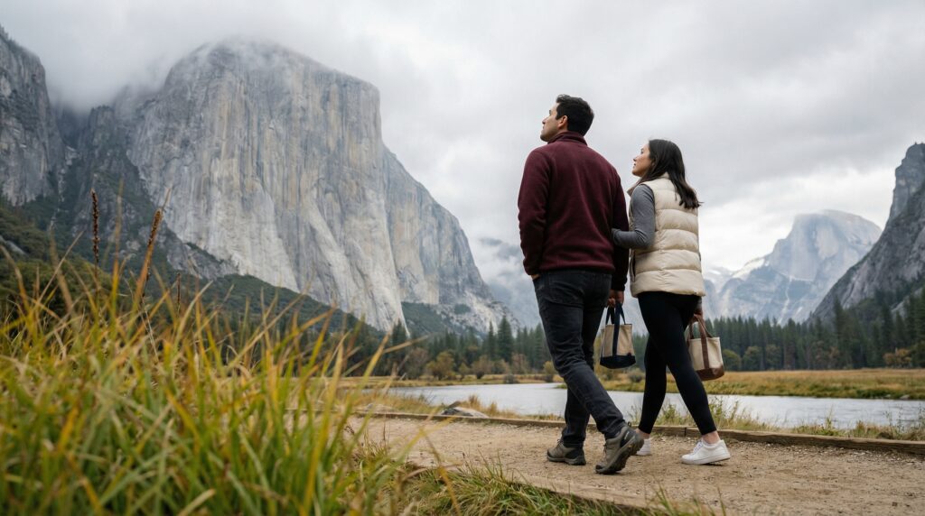
Cook’s Meadow Loop sits in the flat center of Yosemite Valley and gives you unobstructed views of El Capitan, Half Dome, and the valley walls at ground level. The trail stays flat across meadow terrain and doesn’t require any technical footing. One mile takes most people 25 to 35 minutes.
The honest version of this trail: it’s not a hike in the traditional sense. It’s a slow walk through Yosemite Valley, on a path that asks almost nothing of your legs and puts the most-photographed mountain walls in the country directly in front of you. That’s the point. If you want to be in Yosemite Valley without committing to a 6-mile mountain trail, this is your trail.
Logistics note
Yosemite’s timed entry permit system operates May through September and requires a reservation to drive into the valley before 4 PM. Check the National Park Service reservation system at nps.gov before planning any spring or summer visit. Off-season visits (October through April) generally don’t require advance permits.
Punchbowl Falls, Columbia River Gorge, Oregon
📋 Trail Snapshot: Punchbowl Falls
Distance
4.2 miles out-and-back
Elevation Gain
260 feet
Trail Type
Out-and-back
Surface
Packed dirt, forested trail
Dogs Allowed
Yes, on leash
Fee / Permit
Oregon State Sno-Park or day-use permit required seasonally
What to expect on the trail
The trail follows Eagle Creek through old-growth forest and delivers a waterfall payoff at mile 2.1. The elevation gain is spread across the full distance at roughly 62 feet per mile, which barely registers. The forest canopy keeps the trail cool even in summer. Punchbowl Falls itself drops into a clear green pool that is the kind of reward most Easy-rated trails don’t deliver.
The section between miles 1 and 2 narrows and has some rooted terrain. Not technical. Just terrain that requires you to watch your footing rather than stare at your phone. Trail runners handle it cleanly.
Quinault Rain Forest Loop, Olympic National Park, Washington
📋 Trail Snapshot: Quinault Rain Forest Loop
Distance
4.0 miles loop
Elevation Gain
100 feet
Trail Type
Loop
Surface
Packed dirt, boardwalk sections
Dogs Allowed
Yes, on leash (in developed areas)
Fee / Permit
Olympic NP entrance fee
What to expect on the trail
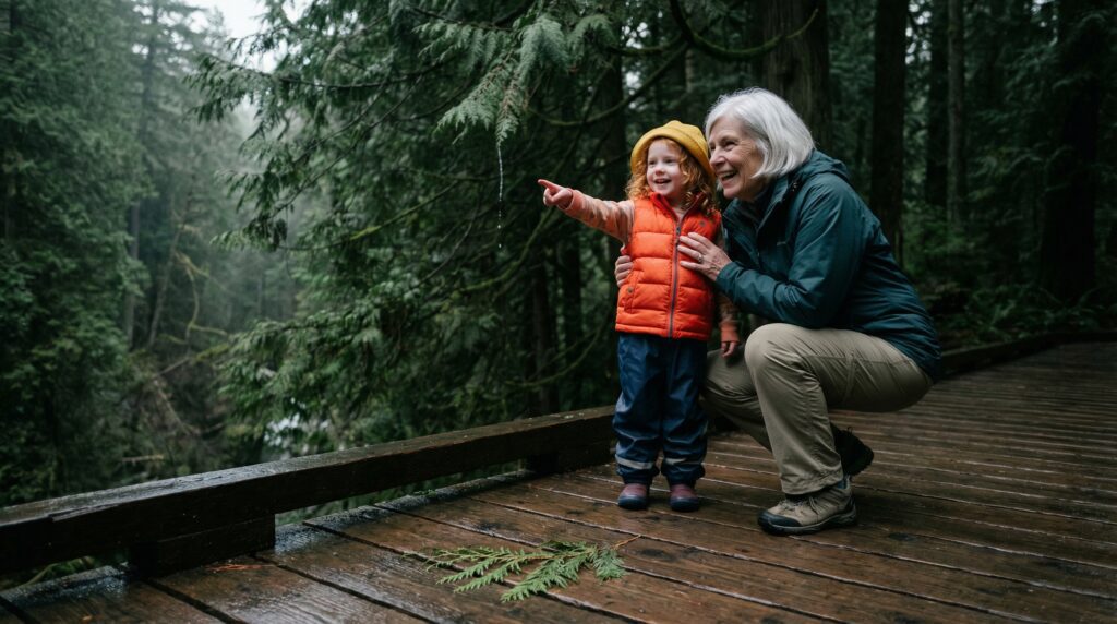
The Quinault loop moves through a temperate rain forest that is as intact as any in the continental United States. Moss covers everything. The canopy closes above you within a quarter mile. The loop is essentially flat and stays interesting for the full 4 miles because the forest changes character across its different sections. Go on a gray day. The light works better for this forest than sunshine does.
🥾 Condition Verification Habit
In my field observations across regional trail systems, beginners frequently drive to popular trailheads without checking seasonal road statuses or local parking pass regulations. In my routine, I always phone the local ranger district office or check municipal park notices 24 hours prior to departure to verify bridge crossings, seasonal water availability, and trail repairs.
Region 2: Southwest (Arizona, Utah, Nevada)
The Southwest delivers the best beginner national park hikes in the country in terms of sheer visual payoff per effort. These three trails are the most accessible entry points in three distinct park environments.
Lower Emerald Pools, Zion National Park, Utah
📋 Trail Snapshot: Lower Emerald Pools
Distance
3.0 miles out-and-back
Elevation Gain
150 feet
Trail Type
Out-and-back
Surface
Paved, then packed dirt
Dogs Allowed
No (shuttle areas)
Fee / Permit
Zion NP entrance fee; shuttle required March–Nov
What to expect on the trail
Lower Emerald Pools is the trail I led this article with, and my opinion on it remains the same: the ratio of effort to reward is among the best on this list. The paved lower section transitions to compact dirt as you approach the lower pool, where a waterfall drops over a sandstone overhang and the pool sits in a natural alcove. The falls are running year-round at varying intensity depending on recent rain.
The shuttle is mandatory in spring and summer. Don’t try to drive to the Grotto Trailhead during peak season. The shuttle system works well and takes about 15 minutes from the visitor center.
Rim Trail, Grand Canyon National Park, Arizona
📋 Trail Snapshot: Rim Trail (Mather Point to Yavapai Point)
Distance
1.3 miles point-to-point (shuttle back)
Elevation Gain
Under 50 feet
Trail Type
Point-to-point
Surface
Paved and packed gravel
Dogs Allowed
Yes, on leash (South Rim Rim Trail only)
Fee / Permit
Grand Canyon NP entrance fee
What to expect on the trail
The Rim Trail runs along the South Rim for 13 miles total, but the Mather Point to Yavapai Point section is the 1.3-mile stretch that delivers the best views relative to the least effort. You’re walking along the canyon edge at a grade that almost never exceeds 2%. The canyon drops 4,000 feet below you. A rim shuttle returns you to your start.
Honest note: the Rim Trail is partly paved and partly packed gravel. It walks more like a scenic path than a trail. That’s the point for a first-timer at the Grand Canyon. The trail into the canyon (Bright Angel) is a completely different experience and is not appropriate for beginners without specific preparation.
Calico Hills Loop, Red Rock Canyon NCA, Nevada
📋 Trail Snapshot: Calico Hills Loop
Distance
2.4 miles loop
Elevation Gain
200 feet
Trail Type
Loop
Surface
Sandy dirt, some rock
Dogs Allowed
Yes, on leash
Fee / Permit
Red Rock Canyon NCA timed entry fee
What to expect on the trail
Red Rock Canyon sits 17 miles west of Las Vegas and receives fewer visitors than its proximity to the Strip suggests. The Calico Hills loop weaves between red and cream sandstone formations at a comfortable grade. The scenery is the point. The hiking is the vehicle to get to it.
Do this one before 9 AM in any month except December or January. The canyon heats fast and is directly exposed to the sun from mid-morning onward.
Region 3: Mountain West (Colorado, Wyoming, Montana)
The Mountain West delivers the best entry level hikes in the country for alpine scenery without alpine commitment. These three trails give beginners genuine mountain terrain without the elevation gain that would make them inappropriate starting points.
Bear Lake Loop, Rocky Mountain National Park, Colorado
Bear Lake Loop is short by design. It circles a glacially carved alpine lake at 9,475 feet elevation with views of Hallett Peak and Flattop Mountain across the water. At that elevation, the lake sits above treeline on the western edge of its shoreline, giving you the kind of mountain panorama that usually requires a full-day approach.
One thing most listings don’t tell you: at 9,475 feet, people who are not acclimatized feel altitude on this trail. Coming from sea level, a short walk that might seem trivial at home can produce elevated heart rate and mild breathlessness here. Take your time on the loop and don’t skip water.
String Lake Loop, Grand Teton National Park, Wyoming
📋 Trail Snapshot: String Lake Loop
Distance
3.8 miles loop
Elevation Gain
110 feet
Trail Type
Loop
Surface
Packed dirt, some roots
Dogs Allowed
No (Grand Teton NP policy)
Fee / Permit
Grand Teton NP entrance fee
What to expect on the trail
String Lake Loop circles a narrow lake between Jenny Lake and Leigh Lake with the Teton Range directly overhead the entire time. The trail is nearly flat because it follows the lake shoreline. What you get for that flat 3.8 miles is some of the most dramatic mountain scenery in the lower 48, with the Cathedral Group reflected in the water on calm mornings.
Go before 9 AM for the reflection. After 10 AM, wind breaks the surface.
Trail of the Cedars, Glacier National Park, Montana
Trail of the Cedars is a boardwalk loop through old-growth western red cedars in the Avalanche Creek drainage. The trees are 500 to 1,000 years old and the forest floor stays cool even in July. At the far end of the loop, the trail passes the Avalanche Creek gorge where the creek has carved a narrow slot through red rock.
At under a mile and essentially flat, this trail works for every fitness level. It’s also fully accessible on the boardwalk sections.
Region 4: Southeast and Appalachians
The Southeast delivers best beginner national park hikes with genuine old-growth forest and waterfall scenery in the most-visited national park in the country.
Laurel Falls Trail, Great Smoky Mountains NP, Tennessee
📋 Trail Snapshot: Laurel Falls Trail
Distance
2.6 miles out-and-back
Elevation Gain
314 feet
Trail Type
Out-and-back
Surface
Paved throughout
Dogs Allowed
No (GRSM paved trail policy)
Fee / Permit
No entrance fee; parking reservation may be required
What to expect on the trail
Laurel Falls is the most visited trail in the Great Smoky Mountains and the most visited waterfall trail in the eastern United States. The 80-foot tiered falls at the end justify the traffic. The paved surface means the 314 feet of gain is spread evenly and never feels steep. Most people reach the falls in 45 to 55 minutes.
What the AllTrails listing doesn’t tell you: the parking lot at the Laurel Falls Trailhead fills before 8 AM on weekends from May through October. Arrive before 7:30 AM or plan to park at a lower lot and add 0.5 miles to your walk.
Linville Falls, Blue Ridge Parkway, North Carolina
The Erwin’s View trail at Linville Falls delivers two successive overlook views of a major Appalachian waterfall and gorge in under a mile of walking. The elevation is gentle and the trail is well-maintained. This is a trail where the distance and the scenery are genuinely proportional in a way that most beginner trail lists don’t capture: you walk 0.8 miles and stand at the edge of a 90-foot plunge falls.
Anhinga Trail, Everglades National Park, Florida
📋 Trail Snapshot: Anhinga Trail
Distance
0.8 miles loop
Elevation Gain
Under 5 feet
Trail Type
Loop
Surface
Paved path and boardwalk
Dogs Allowed
No (Everglades NP policy)
Fee / Permit
Everglades NP entrance fee
What to expect on the trail
The Anhinga Trail is technically flat, being in the Everglades. What it offers is closer wildlife viewing than almost any other trail in the country: anhingas drying wings on railings 3 feet away, alligators along the bank, herons standing motionless in the saw grass. For a beginner who doesn’t hike for physical challenge but for the experience of being somewhere genuinely different, this trail delivers more per mile than any other trail on this list.
Visit between November and April. The summer wet season raises water levels and reduces wildlife concentration along the trail corridor.
Region 5: Northeast and Midwest
The Northeast requires honest calibration on difficulty. Terrain that looks gentle on a map often has rocky or rooted surfaces that change the experience in real ways. All three of these scenic easy hikes in America are genuinely appropriate for beginners.
💡 Trail Tip: The Northeast gets more weekend traffic per trail mile than any other region on this list. AllTrails at alltrails.com shows live crowd levels on popular trails. Check the crowd indicator before you leave, not after you arrive at a full parking lot.
Flume Gorge Trail, Franconia Notch State Park, New Hampshire
📋 Trail Snapshot: Flume Gorge Trail
Distance
2.1 miles loop
Elevation Gain
200 feet
Trail Type
Loop
Surface
Boardwalk, paved, and dirt mix
Dogs Allowed
No (Flume Gorge area)
Fee / Permit
State park entrance fee ($18 adults, $7 kids as of March 2026; verify current rates)
What to expect on the trail
The Flume Gorge trail runs through a narrow granite gorge with a stream running along the bottom and 90-foot walls above. The boardwalk through the gorge itself is 800 feet long and is the trail’s defining feature. The approach and return add trail walking through forest. This trail operates more like an attraction than a wilderness hike, with staffed entrance and maintained facilities throughout.
It’s worth every dollar of the entrance fee. The gorge section is one of the most photogenic 10 minutes in New England hiking.
No fee for this section (Pictured Rocks National Lakeshore)
What to expect on the trail
Miners Beach delivers Lake Superior frontage and sandstone bluff scenery in under 2 miles. The beach itself is the destination: sand, cold clear water, and the colored sandstone cliffs visible from the waterline. The trail from the parking area to the beach is mild and fully accessible to beginners. The wider Pictured Rocks park has harder trails that require more preparation, but this section doesn’t.
Go in late August or early September when the lake temperature is its highest, the mosquitoes are done, and the fall color is starting.
Lost Maples State Natural Area, Texas
📋 Trail Snapshot: Maple Trail Loop
Distance
4.2 miles loop
Elevation Gain
350 feet
Trail Type
Loop
Surface
Packed dirt, some rocky sections
Dogs Allowed
Yes, on leash
Fee / Permit
Texas State Parks day-use fee; capacity limits apply Oct–Nov
What to expect on the trail
Lost Maples delivers a trail experience that Texas doesn’t advertise well: genuine canyon hiking with bigtooth maples that turn gold and orange in late October and early November. The loop follows the Sabinal River for most of its length. The 350 feet of elevation gain is distributed evenly enough that no single section feels hard.
This trail gets extremely crowded in fall color season. Visit on a weekday in late October for the best combination of color and manageable traffic. On fall weekends, the park often reaches capacity by 8 AM and turns visitors away.
How to Plan Your Visit to Any Trail on This List
Before you leave home: the 4-minute check
Every trail on this list of best beginner hikes in the US requires the same four-minute check before you drive. Current permit or reservation status (three of these trails added entry systems after 2020 that aren’t reflected in older blog posts). Parking situation and arrival time recommendation. Recent AllTrails reviews from the last 30 days. And the offline map download.
I’ll be honest about one limitation of this list: permit systems at national parks change more often than any guide can track. Yosemite’s timed entry system, Zion’s shuttle requirements, and Rocky Mountain’s vehicle reservation system have all changed at least once since 2021. The National Park Service website at nps.gov is the only reliable real-time source for current access requirements. Check it before any national park trail.
What to bring for any trail on this list
Every trail here is a day hike under 5 miles. The standard packing applies: 1.5 liters of water, a snack for anything over 90 minutes, a layer, trail-specific shoes, phone with offline map downloaded, and waste bags if you’re bringing a dog. None of these trails require specialized gear.
💡 Trail Tip: For national park trails specifically, arrive at the trailhead at least 30 minutes before your planned start time. Popular park trailheads frequently fill their parking areas before 8 AM on summer and fall weekends. Trails that are technically easy become frustrating experiences when parking adds an unplanned mile of road walking.
Common Mistakes on First Visits to These Trails
Showing up on a Saturday morning without checking parking
Six of the fifteen trails on this list have parking lots that fill before 9 AM on summer weekends. Arriving at 10 AM means parking on a road shoulder and adding real distance to your walk before you’ve started. Check the trail’s AllTrails page for crowd level data the night before, and plan a weekday or early Saturday departure if the data shows high weekend traffic.
Treating national park entrance fees as the only cost
Several trails on this list now require a separate timed entry permit on top of the park entrance fee. The Yosemite Valley reservation system, Zion’s spring and summer shuttle requirement, and Rocky Mountain’s vehicle reservation system are the three most commonly missed. These systems don’t appear in AllTrails listings automatically. Go to nps.gov for the specific park and read the current access page.
Using the AllTrails Easy label without checking the specific section
The Rim Trail entry on this list is a specific 1.3-mile section. The full Rim Trail is 13 miles. The Great Smoky Mountains entry covers only the Laurel Falls Trail, not the 800 miles of other trails in the park. For every trail here, confirm the specific section distance against the specific trailhead before you park.
Not accounting for altitude on Mountain West trails
Bear Lake Loop at Rocky Mountain National Park sits at 9,475 feet. If you’re arriving from sea level, that elevation affects your effort level on even the flattest trail. Drink an extra liter of water the day before your hike, take the loop slowly, and don’t dismiss breathlessness as being out of shape. It’s altitude. It resolves in 24 to 48 hours of acclimatization.
What are the best beginner national park hikes for a family?
The best beginner national park hikes on this list for families with children are: Trail of the Cedars at Glacier (0.9 miles, boardwalk, completely flat), Anhinga Trail at Everglades (0.8 miles, paved, wildlife viewing that holds kids’ attention), and Cook’s Meadow Loop at Yosemite (1 mile, flat, big views). All three work for children under 6 years old at their own walking pace. For school-age children who can manage 2 to 3 miles, Laurel Falls at Great Smoky Mountains and String Lake Loop at Grand Teton are genuinely rewarding trails.
What are the top US hikes for beginners in the Mountain West?
The top US hikes for beginners in the Mountain West from this list are String Lake Loop at Grand Teton (3.8 miles, 110 feet of gain, flat shoreline) and Trail of the Cedars at Glacier (0.9 miles, boardwalk). Bear Lake Loop at Rocky Mountain NP is a third option but requires altitude acclimatization from sea level visitors. All three are national park entries that reward first-timers with mountain scenery that most people assume requires more hiking experience to reach.
Are these scenic easy hikes in America crowded?
Several of the scenic easy hikes in America on this list are among the most visited trails in their respective parks. Laurel Falls at Great Smoky Mountains and Lower Emerald Pools at Zion both see heavy weekend traffic from May through October. The Anhinga Trail at Everglades, Miners Beach at Pictured Rocks, and the Calico Hills Loop at Red Rock Canyon are the three least crowded options on the list. For any national park trail, a weekday arrival before 8 AM produces a genuinely different experience from a Saturday morning at 10 AM.
What are the best entry level hikes for someone returning after years away from hiking?
The best entry level hikes for someone returning to trail hiking after a long break are the ones with the shortest distance, the most forgiving surface, and the clearest waymarking. From this list: Cook’s Meadow Loop at Yosemite (1 mile, minimal gain, paved and dirt), the Anhinga Trail at Everglades (0.8 miles, boardwalk), and Trail of the Cedars at Glacier (0.9 miles, boardwalk). These three let you get your legs and lungs calibrated to trail conditions without committing to a distance that outpaces where your fitness actually is.
The Trails Are Already There
The best beginner hikes in the US are waiting for you in exactly the same condition they’ve been in for decades. National parks protect these corridors precisely so that the trail you read about this week is still the same trail when you get there.
My opinion on where to start: go to a national park for your first real trail. The infrastructure, the maintained surfaces, and the scenery-to-effort ratio at parks like Zion, the Smokies, or Glacier are better than almost any local park equivalent. Scenic easy hikes in America are most concentrated in the national park system, and the entrance fees are the best value in outdoor recreation. Best entry level hikes are everywhere. The ones on this list are the ones where the first impression of trail hiking is most likely to bring you back.
Next Steps
Right now: Pick one trail from the region closest to you. Open AllTrails, find it, check the current reviews from the last 30 days, and verify the current permit and fee status at the park’s nps.gov page.
Before your first hike: Download the offline map. Check parking timing based on reviews. Pack 1.5 liters of water, a snack, and a layer. Plan arrival at the trailhead at least 30 minutes before your start time.
After your first hike: Note which region delivered the best ratio of effort to experience for you. That data shapes your next outing better than any list can.
Frequently Asked Questions
What are the best beginner national park hikes for a family?
The best beginner national park hikes on this list for families with children are: Trail of the Cedars at Glacier (0.9 miles, boardwalk, completely flat), Anhinga Trail at Everglades (0.8 miles, paved, wildlife viewing that holds kids' attention), and Cook's Meadow Loop at Yosemite (1 mile, flat, big views). All three work for children under 6 years old at their own walking pace. For school-age children who can manage 2 to 3 miles, Laurel Falls at Great Smoky Mountains and String Lake Loop at Grand Teton are genuinely rewarding trails.
What are the top US hikes for beginners in the Mountain West?
The top US hikes for beginners in the Mountain West from this list are String Lake Loop at Grand Teton (3.8 miles, 110 feet of gain, flat shoreline) and Trail of the Cedars at Glacier (0.9 miles, boardwalk). Bear Lake Loop at Rocky Mountain NP is a third option but requires altitude acclimatization from sea level visitors. All three are national park entries that reward first-timers with mountain scenery that most people assume requires more hiking experience to reach.
Are these scenic easy hikes in America crowded?
Several of the scenic easy hikes in America on this list are among the most visited trails in their respective parks. Laurel Falls at Great Smoky Mountains and Lower Emerald Pools at Zion both see heavy weekend traffic from May through October. The Anhinga Trail at Everglades, Miners Beach at Pictured Rocks, and the Calico Hills Loop at Red Rock Canyon are the three least crowded options on the list. For any national park trail, a weekday arrival before 8 AM produces a genuinely different experience from a Saturday morning at 10 AM.
What are the best entry level hikes for someone returning after years away from hiking?
The best entry level hikes for someone returning to trail hiking after a long break are the ones with the shortest distance, the most forgiving surface, and the clearest waymarking. From this list: Cook's Meadow Loop at Yosemite (1 mile, minimal gain, paved and dirt), the Anhinga Trail at Everglades (0.8 miles, boardwalk), and Trail of the Cedars at Glacier (0.9 miles, boardwalk). These three let you get your legs and lungs calibrated to trail conditions without committing to a distance that outpaces where your fitness actually is.
Related Reads
Showed up at a trailhead expecting free parking and got hit with a fee you weren’t prepared for? Here’s why hiking trails actually cost money and where that fee is really going.
Oliver Fall is an outdoor enthusiast with over 8 years of trail and backcountry hiking experience across Southern California. Two years ago, he founded Fama to break down real-world gear advice, practical trail skills, and honest beginner mistakes to help newcomers explore the outdoors with confidence.