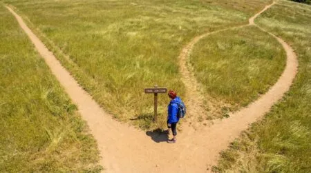



What are cairns on hiking trails? They’re stacked piles of rocks placed along a route to mark the path, indicate a turning point, or guide hikers through sections where no defined trail tread exists. If you’ve ever walked a rocky alpine trail, crossed open desert slickrock, or navigated above treeline where painted blazes can’t survive the weather, you’ve seen them: small stone towers sitting at key points along the route, anywhere from three flat rocks to knee-high stacks.
⚡ Quick Trail Takeaways
- Cairn Navigation: Official rock cairns mark indistinct alpine routes where soil or granite slabs cannot hold a worn dirt path.
- Leave No Trace Rule: Never build decorative cairns or alter existing ones; false cairns mislead hikers into hazardous terrain.
- Verification Step: Cross-reference every cairn with an offline topographic GPS map before committing to an unfamiliar spur.
Here’s my honest admission about the first time I encountered one: I assumed every stack of rocks I spotted from then on was an official trail marker. That assumption led me 200 feet off the main path on a granite slab in California before I realized the trail had turned left and I’d followed a decorative pile that had nothing to do with the route. What I didn’t know was that there are two completely different types of rock stacks on trail, and when you’re new, they’re nearly impossible to tell apart.
This guide covers what are cairns on hiking trails, what their actual purpose is, why unofficial stacks have created real navigation problems on popular trails, what Leave No Trace says about building your own, and the three-second check that keeps you from following the wrong one.
🥾 Oliver’s Trail Notes & Field Observations
Navigating through fractured granite boulder fields above San Gorgonio in dense cloud cover, official stone cairns were the only visual markers keeping me from wandering off an alpine ridge. In my experience, authentic trail cairns are constructed by trail stewards at deliberate sightlines across bedrock where boots cannot carve dirt tread. They are essential navigational markers, not trail decor.
What Are Cairns on Hiking Trails: The Full Answer
The cairns hiking meaning in plain terms
A cairn is a deliberate stack of rocks used as a landmark or trail marker. The cairns hiking meaning traces back to Scots Gaelic: “carn” means a heap of stones used to mark a location. That origin is still accurate today. Cairns have served as navigation waypoints on mountain routes for thousands of years, and the function hasn’t changed.
On a modern trail, an official cairn serves one specific purpose: route marking at a point where the path is not obvious from the terrain alone. Not decoration. Not a visitor tradition. A navigation signal placed by trail crews or land managers at a spot where, without it, hikers would have to guess which direction the route continues.
What are cairns on hiking trails and where do you find them
Official cairns appear where conventional trail marking methods can’t work reliably. Above treeline on alpine routes, where rocky terrain covers the surface and no worn dirt path exists. On desert slickrock in canyon country, where the “trail” is a painted stripe across open sandstone with cairns at key turns. On rocky coastal paths and beaches where the terrain offers no tread to follow. Anywhere that painted blazes would fade quickly or signs can’t be anchored securely.
On well-maintained forest trails with clear tread and regular signage, you almost never need cairns. That distinction becomes important when you’re trying to judge whether a specific rock stack is an official marker or something else entirely.
Truth 1: Trail Cairns Have an Official Purpose
Purpose of trail cairns on marked routes
Understanding what are cairns on hiking trails starts with knowing why the official ones exist. The purpose of trail cairns is to answer a navigation question at a moment when the terrain doesn’t answer it for you: “Which direction does the route continue from here?” On obvious dirt trail, that question doesn’t come up. On open granite slab above treeline or across desert sandstone, it comes up constantly.
According to the National Park Service, cairns are maintained trail infrastructure in parks and wilderness areas where rocky terrain makes other marking methods impractical. Trail crews inspect them seasonally, rebuild them after winter snowpack collapses them, and reposition them when routes are rerouted. They’re treated the same way a painted blaze or a junction sign is treated: a maintained navigation aid with a specific placement reason.
The detail about purpose of trail cairns that matters most for beginners: they’re positioned at decision points. A junction where two paths look equally plausible. A section of open rock where the route disappears into the terrain. A turn that would be easy to miss at pace. If you’re walking along clearly defined trail and a cairn appears in the middle of the path with no navigation question in sight, that cairn is almost certainly not an official marker.
How cairns work on alpine terrain versus desert slickrock
The two environments where cairns are most relied upon as the primary marking system operate differently. On alpine terrain above treeline, cairns are typically built with flat stones from the local geology that interlock for stability, spaced so the next cairn is visible from the previous one. The system is designed as a chain: lose the chain and you lose the route. On desert slickrock in places like Zion National Park and the canyon country of southern Utah, cairns are positioned across open sandstone where the route would otherwise be unmarked. In both environments, the system works because it’s maintained as a network. Move a single cairn and you break a link that other hikers are depending on.
🥾 Cairn Ethics & Safety Warning
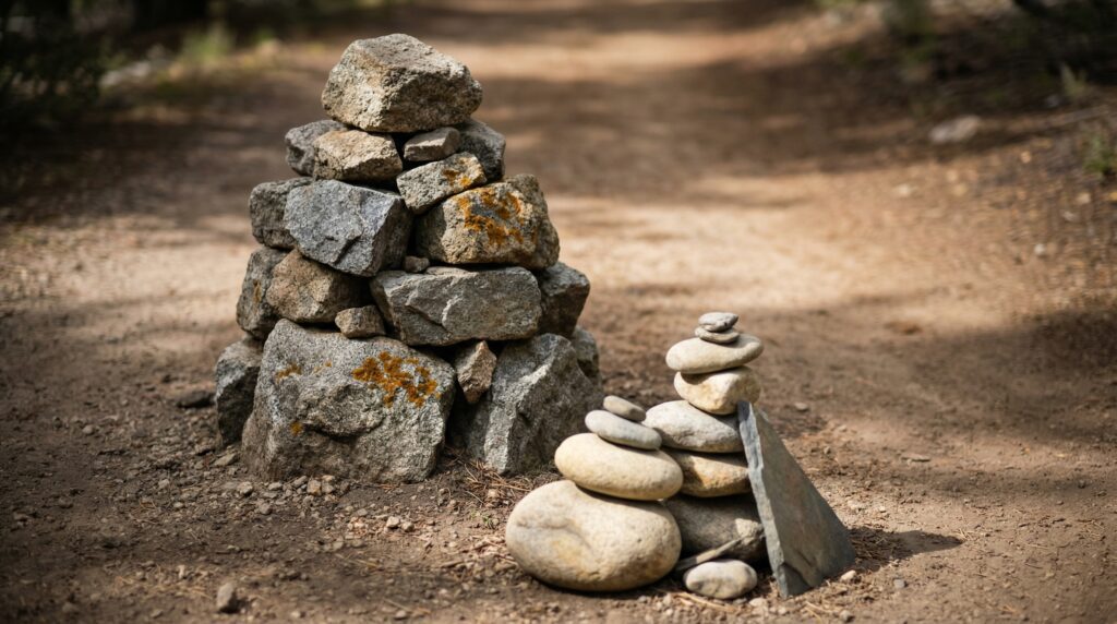
In recent seasons across popular Angeles Crest trails, I have dismantled numerous decorative rock stacks built by tourists beside running streams. As I learned from forest service wilderness rangers, unauthorized decorative cairns disorient hikers onto false herd paths that dead-end at cliffs, while stripping rocks disrupts sensitive aquatic salamander and insect habitats. Practice strict Leave No Trace: never build stone stacks, and never tamper with official trail cairns.
Truth 2: Most Rock Stacks on Trail Are Not Official Markers
The unofficial rock stacks on trail problem
On high-traffic trails near viewpoints, water sources, and frequently photographed locations, unofficial rock stacks built by passing hikers have multiplied to the point where they can outnumber official cairns by significant margins.
The Leave No Trace Center for Outdoor Ethics has identified decorative stone stacking as a navigation hazard specifically because beginners can’t reliably distinguish an official route marker from a recreational pile. A carefully balanced artistic stack and a maintained trail cairn look nearly identical to someone who hasn’t been told what to look for.
Social media has made this worse. A well-balanced cairn at a viewpoint photographs well, gets shared, and more hikers build stacks at the same spot. On a popular trail, a single viewpoint area can accumulate dozens of unofficial rock stacks in a season, pointing in different directions, with none of them serving as official trail markers.
Why this matters when you’re reading the trail
The biggest challenge with what are cairns on hiking trails right now is signal-to-noise. If you’re navigating by stacked rocks and unofficial piles outnumber official route markers on a given section, you’re not navigating. You’re guessing.
Here’s a position I’ll put plainly: official cairns are navigation tools, and the decorative rock stacks you see on popular trails are something else entirely. Treating them as the same thing is how hikers end up off-route on trails that are actually well-marked.
That’s not an argument against trusting all cairns. It’s an argument for learning what the official ones look like in a given environment and using them as one data point rather than your only one.
Truth 3: Navigating by Cairns Has Real Limits
When cairns are reliable route markers
Navigating by cairns works reliably when specific conditions are met: you’re on a trail where cairns are the established marking system maintained by the land manager, the cairns are visually consistent with each other in rock type, approximate size, and spacing, and you can see the next one clearly from where you’re standing. In those conditions, trust them.
National parks across the American West, including Rocky Mountain National Park and Grand Teton, use cairn systems on alpine routes above treeline. The land managers maintain them specifically because they work in terrain where nothing else does. On those trails, a cairn at a fork is giving you accurate information.
💡 Trail Tip: Download your trail map offline before leaving the parking lot. On AllTrails, tap the download icon on the trail page before you drive into areas without cell service. Cairns work best as one layer in how you navigate, not as the only data source.
When navigating by cairns leads you wrong
Navigating by cairns gives you bad information in four specific situations: the trail has heavy recreational use and unofficial stacks have proliferated into the official marking system, you’re on a trail type that uses painted blazes or signs as its primary marking method and cairns aren’t officially maintained, weather or other hikers have knocked official cairns over without anyone rebuilding them, or you’re following a cairn that marks a spur to a viewpoint rather than the continuation of your main route.
That last failure mode is worth understanding in detail. On popular trails, hikers sometimes build cairns to mark a detour to a swimming hole, a shortcut to a campsite, or a spur to a viewpoint. These look identical to official route markers. Following them takes you off the main trail and sometimes onto unmaintained terrain.
The 100-foot search rule when you lose a cairn
If you lose visual contact with the next cairn and can’t find it within 100 feet of searching in the logical direction of travel, stop. Continuing to cover ground in the wrong direction makes your situation worse, not better. Pull up your downloaded trail map, locate your position, and use the map to find the route rather than searching for another rock pile that may not be an official marker anyway.
Truth 4: Leave No Trace Cairns Rules Are Not Suggestions
What leave no trace cairns guidance actually says
The Leave No Trace Center for Outdoor Ethics is specific on this: don’t build new cairns on trail, and when you encounter unofficial ones, dismantle them by scattering the rocks back to their natural position. This falls under the “Leave What You Find” principle, and the guidance isn’t ambiguous.
The case rests on two arguments. The ecological argument: rocks stacked into cairns disturb habitat under and between them. Insects, small reptiles, and soil organisms live in rock crevices on alpine and desert surfaces. A single cairn is a minor disturbance. Thousands of cairns built and rebuilt across a summer season on a popular trail accumulates into something measurable on fragile terrain.
The navigation argument: unofficial cairns interfere with the marking system that official cairns create. Trail crews in high-use wilderness areas spend time on every maintenance visit dismantling unofficial cairns rather than rebuilding damaged official ones. The American Hiking Society has documented this as a recurring maintenance burden in high-traffic wilderness corridors.
The cumulative effect of ignoring this guidance
What happens when enough hikers ignore that guidance on a single popular trail: the official marking system becomes impossible to read. Official route markers disappear into the noise of recreational stacks. A beginner navigating by rock piles on that trail is essentially navigating randomly, following whatever structure looks intentional.
Truth 5: What to Do When You Spot a Cairn on the Trail
The three-second check
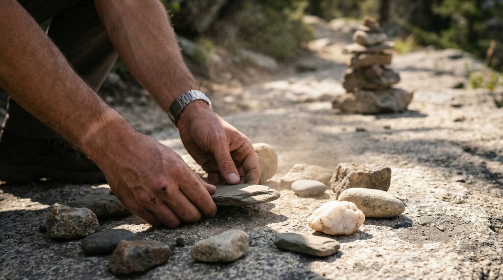
Cairns are useful for confirming your route at genuine decision points where the path isn’t visually obvious. When you spot one, run three quick checks: Is there an actual navigation question at that spot? Does it match the size, rock type, and spacing of other cairns on the route? And does it point toward the trail’s continuation rather than a side path? If a cairn appears on clear trail with no fork or ambiguity, it’s likely unofficial and can be ignored.
Building a navigation approach that doesn’t hinge on cairns
Understanding what are cairns on hiking trails clearly changes how you read a trail. Cairns belong as one layer in how you navigate, not the foundation of the system. The approach that works for beginners: download the trail map offline before you leave the parking lot, screenshot the route at zoom level while you still have cell range, and check your position against the map at any point where you’re unsure rather than looking for the next rock pile.
A cairn two miles back doesn’t tell you where you are now. Your map tells you that. Use cairns to confirm you’re on route at a specific moment. Use your map to understand where that moment fits in the full picture.
What are cairns on hiking trails and are they always official trail markers?
What are cairns on hiking trails comes down to context. Official cairns are placed and maintained by land managers at navigation decision points, primarily on alpine terrain and open desert routes where trail tread is undefined. Unofficial rock stacks built by hikers are also common on popular trails, particularly near viewpoints and water, and they look nearly identical to official ones. The safest approach for beginners: treat cairns as route confirmation, cross-reference with a downloaded trail map, and don’t rely on any rock pile as your only navigation source.
What is the cairns hiking meaning and where does the term come from?
The cairns hiking meaning is a rock stack used as a landmark or trail marker. The word traces to Scots Gaelic, where “carn” referred to a heap of stones marking a location, and cairns have been used as navigation waypoints on mountain terrain for thousands of years. On US trails today, the cairns hiking meaning technically applies to both official maintained markers and the recreational stacks hikers build near viewpoints, which is part of why the term has become navigationally confusing in practice.
What is the purpose of trail cairns in national parks?
The purpose of trail cairns in national parks and managed wilderness areas is route marking in terrain where painted blazes and signs can’t be used effectively: above treeline, on desert slickrock, on rocky coastal paths. The National Park Service maintains cairns as trail infrastructure in these environments, rebuilding them after weather damage and repositioning them when routes change. They’re placed specifically at decision points, not distributed continuously along an obvious path.
What does leave no trace cairns guidance say about building your own?
Leave No Trace cairns guidance is direct: don’t build them, and when you encounter unofficial ones on trail, scatter the rocks back into a natural arrangement. The “Leave What You Find” principle covers altering the landscape in ways that affect other visitors’ experience, and unofficial cairns do exactly that by cluttering the navigation system that official cairns create. The reasoning covers both ecological disturbance under stacked rocks and the maintenance burden created for trail crews. The guidance applies regardless of how harmless a single stack seems. The cumulative effect of many hikers building them is what creates the documented problem.
Is navigating by cairns reliable on most US hiking trails?
Navigating by cairns is reliable in areas where cairns are the official maintained marking system: above-treeline alpine routes, desert slickrock, rocky coastal paths managed by agencies that actively maintain them. It becomes unreliable on high-traffic trails where unofficial stacks outnumber official ones, on forest trails where painted blazes or signs are the standard marking method, and on any section where weather or use has knocked official cairns over without maintenance. For beginners, the most reliable practice is using cairns alongside a downloaded trail map rather than as a standalone navigation system.
How do you tell an official cairn from a hiker-built rock stack?
Official cairns on maintained routes tend to share visual characteristics: consistent rock size drawn from local geology, spacing that keeps each cairn visible from the previous one, and placement at genuine navigation decision points rather than along obvious trail. Hiker-built rock stacks tend to appear at scenic or photogenic spots, are often more elaborate or artistically balanced, and show up where no navigation decision is actually needed. On high-traffic trails, this distinction breaks down as unofficial stacks spread across the entire trail. When genuinely uncertain, cross-reference with your trail map rather than trusting the rock pile.
Cairns Are Markers. Use Them Like It.
What are cairns on hiking trails comes down to this: an official cairn is a navigation tool placed at a specific point by someone maintaining the trail. Most of the rock stacks you’ll encounter on popular trails are something else, and the difference matters when you’re making route decisions.
Learn the difference between a maintained official marker and a recreational stack. Download your trail map before every hike so cairns become confirmation rather than your only guide. Don’t build your own. Scatter unofficial ones when you encounter them on trail — it’s a principle backed by Leave No Trace, which treats recreational cairn building as a form of trail impact that degrades the navigation system for everyone behind you. The navigation system that official cairns provide works best when it’s consistent and clear, not buried in recreational noise.
Next Steps
- Before your next hike: Download your trail map offline. On AllTrails, tap the download icon on the trail page before you lose cell range. Do it in the parking lot, not halfway in.
- On the trail: When you see a rock stack, run the three-second check. Is a navigation decision actually needed here? Is this cairn consistent with others on this route? If neither answer is yes, treat it as decoration and keep moving on your mapped route.
- After your hike: Look up the land manager’s website for the trail you hiked. National park and Forest Service trail pages often specify what marking systems they use and where cairns are official. Five minutes of reading before a hike changes what you see on the trail.
Frequently Asked Questions
What are cairns on hiking trails and are they always official trail markers?
What are cairns on hiking trails comes down to context. Official cairns are placed and maintained by land managers at navigation decision points, primarily on alpine terrain and open desert routes where trail tread is undefined. Unofficial rock stacks built by hikers are also common on popular trails, particularly near viewpoints and water, and they look nearly identical to official ones. The safest approach for beginners: treat cairns as route confirmation, cross-reference with a downloaded trail map, and don't rely on any rock pile as your only navigation source.
What is the cairns hiking meaning and where does the term come from?
The cairns hiking meaning is a rock stack used as a landmark or trail marker. The word traces to Scots Gaelic, where "carn" referred to a heap of stones marking a location, and cairns have been used as navigation waypoints on mountain terrain for thousands of years. On US trails today, the cairns hiking meaning technically applies to both official maintained markers and the recreational stacks hikers build near viewpoints, which is part of why the term has become navigationally confusing in practice.
What is the purpose of trail cairns in national parks?
The purpose of trail cairns in national parks and managed wilderness areas is route marking in terrain where painted blazes and signs can't be used effectively: above treeline, on desert slickrock, on rocky coastal paths. The National Park Service maintains cairns as trail infrastructure in these environments, rebuilding them after weather damage and repositioning them when routes change. They're placed specifically at decision points, not distributed continuously along an obvious path.
What does leave no trace cairns guidance say about building your own?
Leave No Trace cairns guidance is direct: don't build them, and when you encounter unofficial ones on trail, scatter the rocks back into a natural arrangement. The "Leave What You Find" principle covers altering the landscape in ways that affect other visitors' experience, and unofficial cairns do exactly that by cluttering the navigation system that official cairns create. The reasoning covers both ecological disturbance under stacked rocks and the maintenance burden created for trail crews. The guidance applies regardless of how harmless a single stack seems. The cumulative effect of many hikers building them is what creates the documented problem.
Is navigating by cairns reliable on most US hiking trails?
Navigating by cairns is reliable in areas where cairns are the official maintained marking system: above-treeline alpine routes, desert slickrock, rocky coastal paths managed by agencies that actively maintain them. It becomes unreliable on high-traffic trails where unofficial stacks outnumber official ones, on forest trails where painted blazes or signs are the standard marking method, and on any section where weather or use has knocked official cairns over without maintenance. For beginners, the most reliable practice is using cairns alongside a downloaded trail map rather than as a standalone navigation system.
How do you tell an official cairn from a hiker-built rock stack?
Official cairns on maintained routes tend to share visual characteristics: consistent rock size drawn from local geology, spacing that keeps each cairn visible from the previous one, and placement at genuine navigation decision points rather than along obvious trail. Hiker-built rock stacks tend to appear at scenic or photogenic spots, are often more elaborate or artistically balanced, and show up where no navigation decision is actually needed. On high-traffic trails, this distinction breaks down as unofficial stacks spread across the entire trail. When genuinely uncertain, cross-reference with your trail map rather than trusting the rock pile.
Related Reads
Hit a fork in the trail with a faded paint splotch on a tree and had absolutely no idea which way it was pointing? Here are 8 trail marker blazes worth knowing before you take a chance on the wrong one.
Held off on a hike for weeks because you didn’t own “proper” hiking boots yet? Here’s the honest truth about hiking in running shoes instead of waiting around for gear you might not even need.
Got talked into a trail distance that sounded fine on paper but felt completely wrong once your legs were actually moving? These 5 rules help you settle on a number that’s genuinely yours, not someone else’s idea of doable.
Scrolled through a massive packing checklist online and had no clue which items actually mattered versus which were just filler? Here’s a breakdown of the real 10 essentials, no overpacking required.
Felt that sinking moment when nothing on the trail matched what your map said it should look like? Here are 5 steps to actually follow if you get lost hiking, the kind that keep a stressful moment from spiraling.